 English
 Spanish
 Portuguese
Location of Machu Picchu
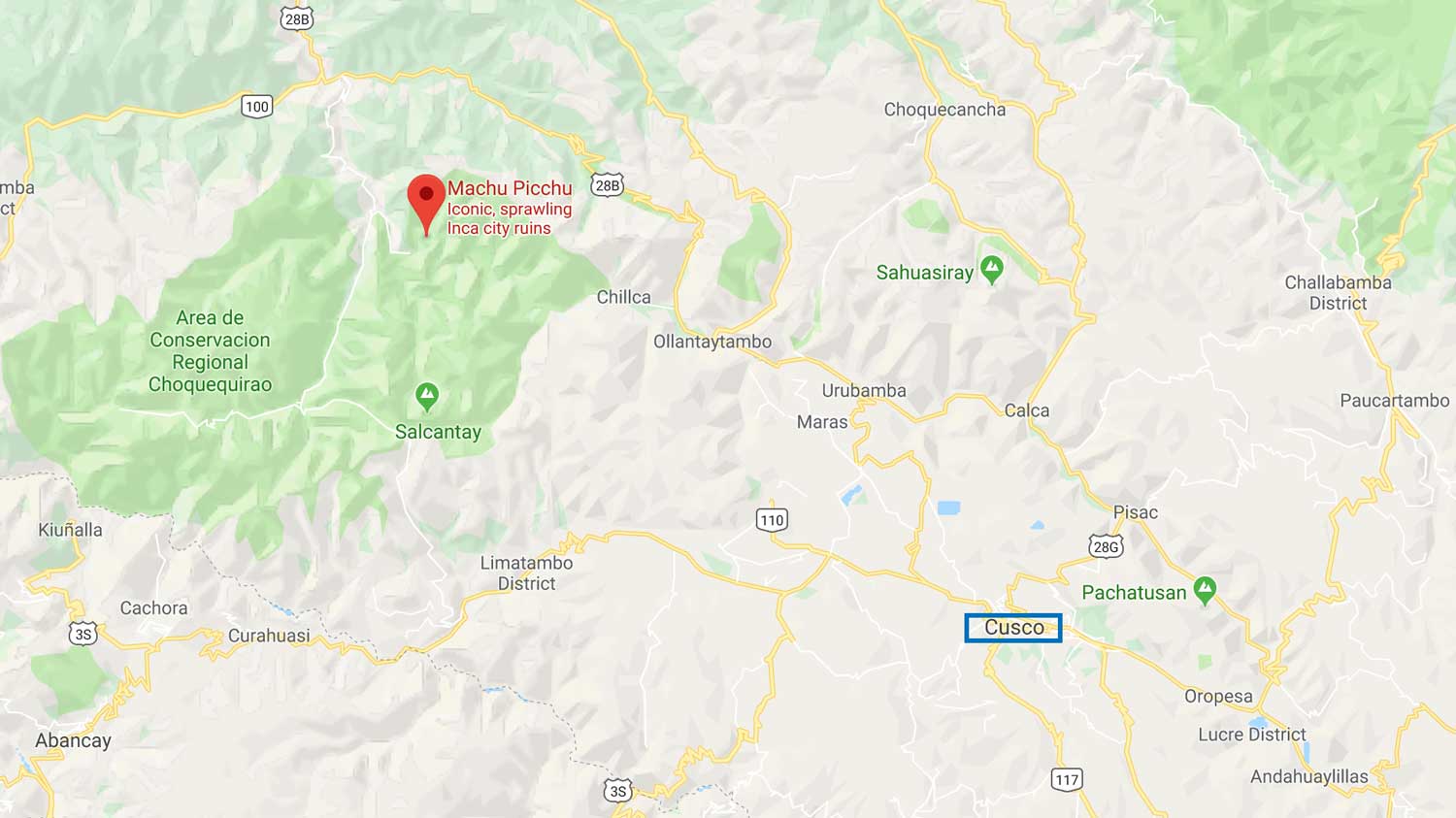
Most people think that the location of Machu Picchu is a few meters from the city of Cusco.
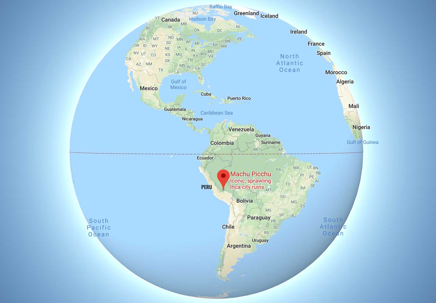
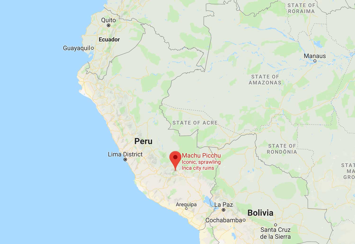
Machu Picchu is located in the Eastern Cordillera of southern Peru, on a mountain ridge of 2,430 meters (7,970 feet).
It is located in the Region of Cusco, Province of Urubamba, District of Machupicchu, on the Sacred Valley. Which is 80 kilometers (50 miles) northwest of Cusco.
Source Wikipedia.
Through which flows the Urubamba River, cutting the Cordillera and creating a canyon with a tropical mountain climate.
The surface of the Archaeological Park, the urban and agricultural area, covers a total of 32,592 hectares.
It is located on the eastern slope of the Vilcabamba Mountain Range, bordering the Apurimac and Urubamba Rivers.
It is located at 13° 9’47 “South Latitude and 72° 32′ 44” West, in the province of Urubamba. The nearest main city is Cusco, the capital region and ancient capital of the Incas, 130 km away.
The mountains, Machu Picchu and Huayna Picchu are part of a larger formation. Located in the Central Cordillera of the Peruvian Andes. It is on the left bank of the Urubamba Canyon formerly known as Quebrada de Picchu.
Machu Picchu Layout
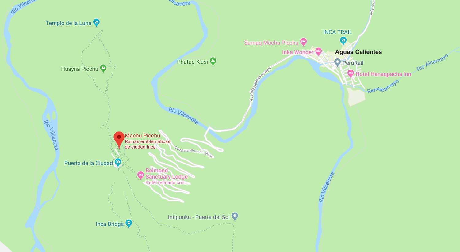
At the foot of the hills is the river Vilcanota or Urubamba. The Inca archaeological site is halfway between the peaks of two mountains, 450 meters above the valley and 2,438 meters above sea level.
The constructed surface is approximately 530 meters long by 200 meters wide, with 172 buildings in its urban area. Biogeographically it is located in the ecoregion of the Peruvian Yungas.
Protected areas by location
The Historic Sanctuary of Machu Picchu extends over an area of 32,592 hectares.
The sanctuary protects a number of biological species in danger of extinction in several Inca establishments, including Machu Picchu which is considered the main one.
The location of Machu Picchu allows that within the sanctuary there are ten inhabited areas and two different ecoregions.
Among them, the most important are the ecologically Andean grasslands, the high dwarf forests and the high forest (or yunga), including the cloud forest and the mountain eyebrow.
This immense diversity of habitat, at the same time, has led to an amazing diversity of flora and fauna.
In fact, the sanctuary has most of the biodiverse ecosystems that surround it and many native species that deserve protection.
The climate is temperate throughout the year, quite rainy between November and March, dry and hot from April to October.
A suitable season is recommended for the visit. The minimum annual temperature is between 8 and 11.2 degrees Celsius.
In June, July and August the temperature is usually below freezing. The maximum annual temperature varies from 20.4 to 26.6 degrees Celsius.
Machu Picchu is home to the highest Inca archeological expression. Is the most visited and internationally known of Peru.
A tourist destination of the first order.
The capital of the district is called Aguas Calientes, a small town that offers accommodation to tourists.
Serves as a recreational center for all travelers to Machu Picchu, also has hot springs that are the delight for travelers.
How to get to machu Picchu?
We have a complete section where we explain in detail how to get to Machu Picchu.
Read more about How To get to Machu Picchu from Cusco.