 English
 Spanish
 Portuguese
Maps of Machu Picchu
Machu Picchu is one of the most important Inca citadels that was discovered in 1911 and is located in the high jungle of the Andes of Peru. To reach this place you must make an expedition of at least 1 full day from the city of Cusco.
When you begin to prepare your visit to Machu Picchu, you will surely want to see the map of where it is located and how to get there and also how the sectors of the famous archaeological site of the Incas are distributed.
Below you will find several maps of Machu Picchu and the main routes to get there.
Machu Picchu on the global map
Located in South America, Peru.
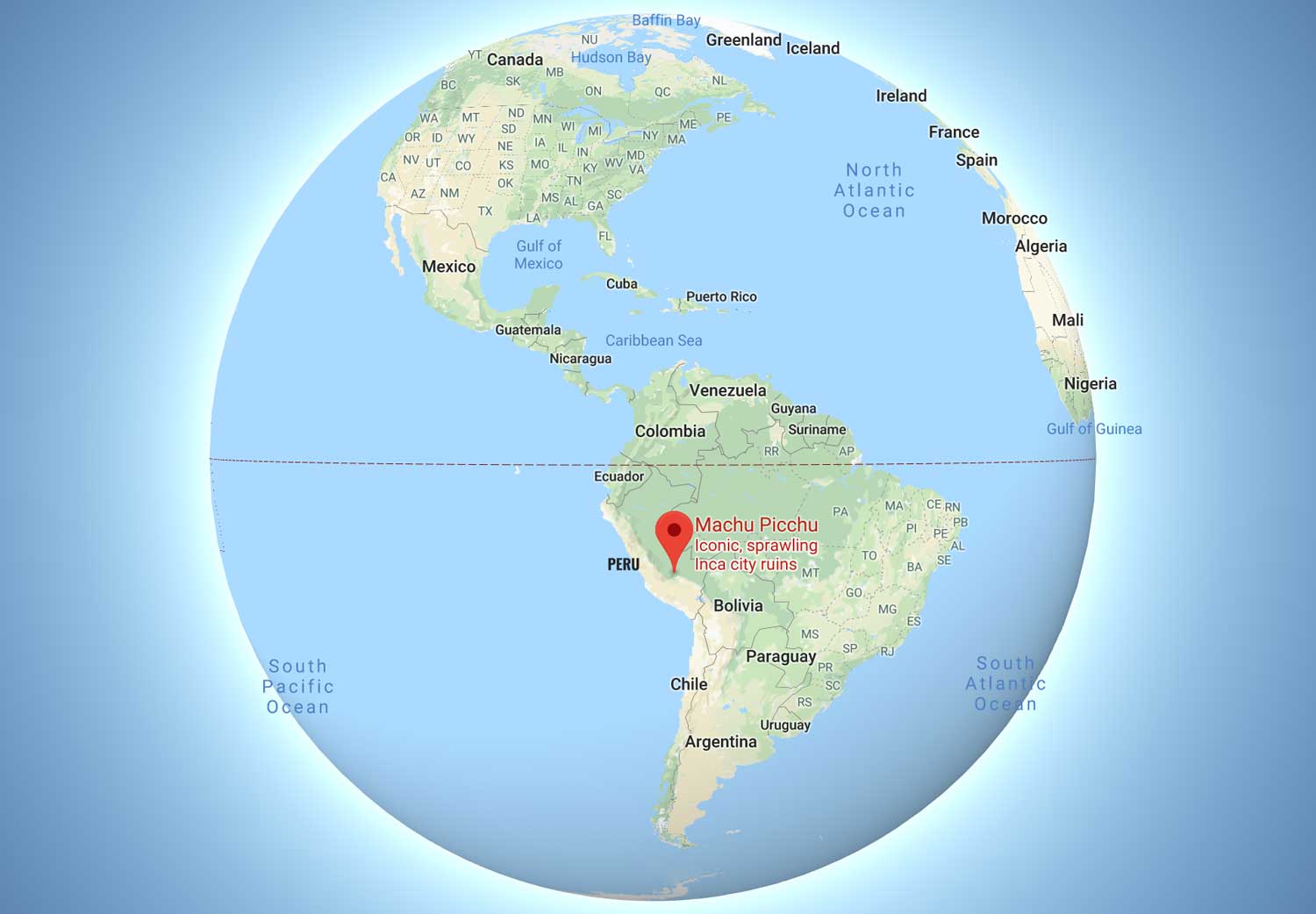
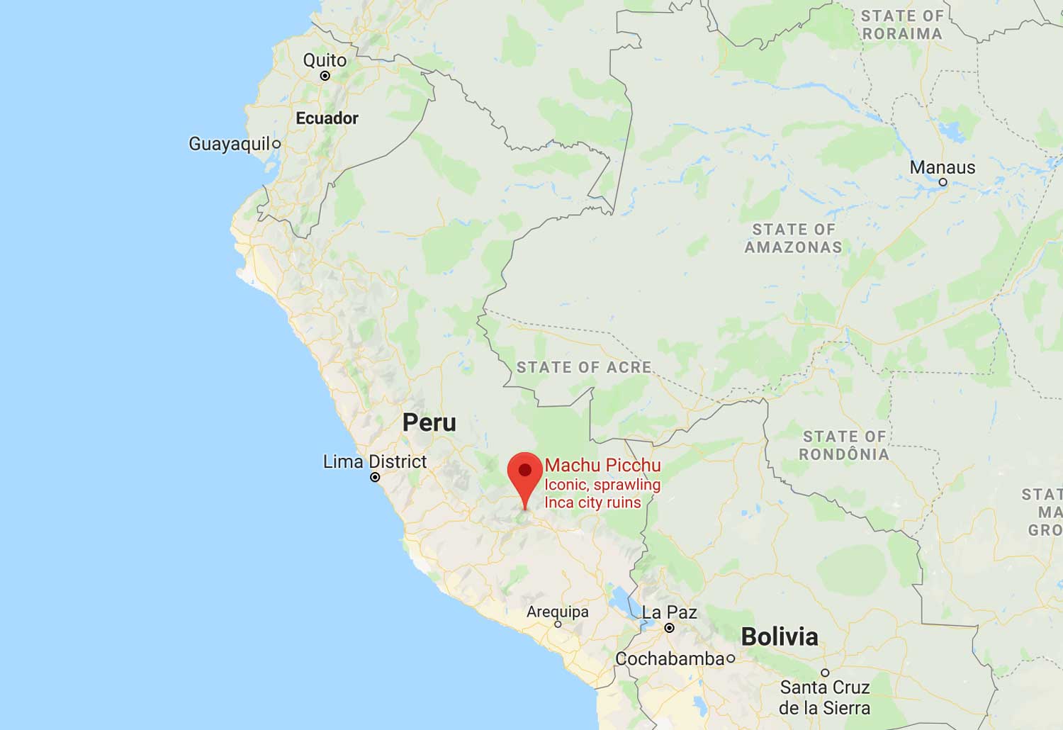
Location of Machu Picchu in the map of Peru
Machu Picchu is located in the South American country of Peru. The “Inca City” is located in the south of the country, in the region of Cusco, in the eastern part of the Peruvian Andes. At its feet is the Vilcanota River. On its summits are the mountains of Huayna Picchu, Putucusi, Salkantay and Machu Picchu.
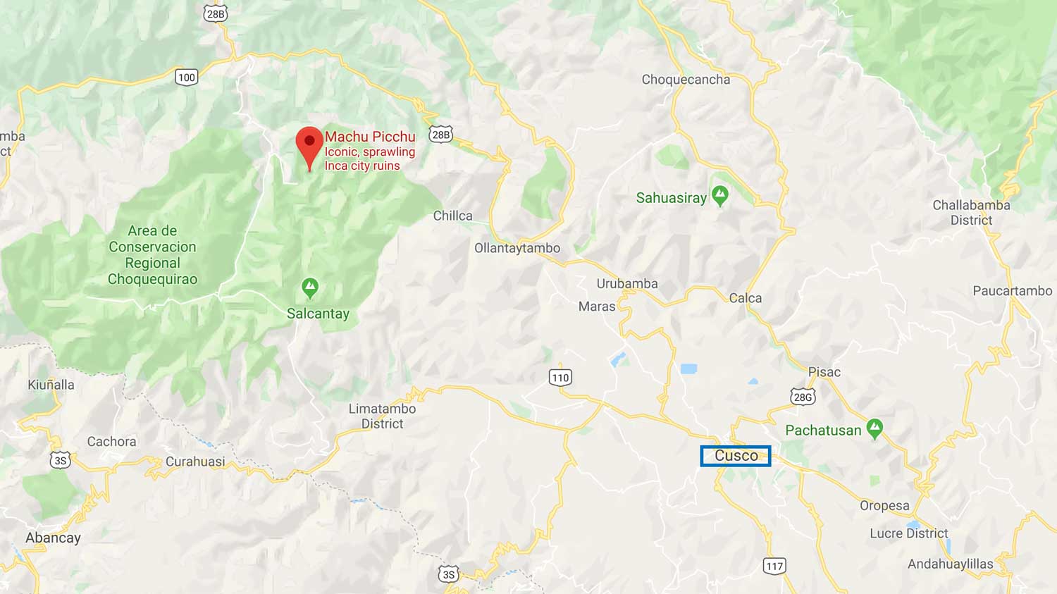
Location of Machu Picchu from Cusco
Machu Picchu is located in the jungle zone of Cusco. it takes 2 hours by car to Ollantaytambo + 1 hour by train to Aguas Calientes.
Read more about Machu Picchu Location.
Routes to get to Machu Picchu
To get to Machu Picchu from anywhere in the world, you must first fly to Lima, Peru. From Lima, there are two routes to get to Cusco (take a bus or fly), and then we have the option to take the train or hike.
Read our complete guide of How to get to Machu Picchu from Cusco.
How to go from Lima to Machu Picchu?
From Lima you have the possibility to take a bus to Cusco or fly, the best option is to fly, since the bus takes about 24 hours and flying takes about 1 hour.
How to go from Cusco to Machu Picchu?
From Cusco to Machu Picchu you have 3 options to go. The first is to go by train from Poroy, the second option is to take a bus to Ollantaytambo station and then train to Aguas Calientes. The third option is to do a trek of 4 days and 5 days (Inca Trail, Salkantay trek, etc).
How to go from Aguas Calientes to Machu Picchu?
From Aguas Calientes to the Inca citadel we can take a bus for 20 minutes or choose to walk for 1 hour and a half.
Hiking trails to Machu Picchu
There are several trekking routes to Machu Picchu, the two most popular are: 4-day Inca Trail and Salkantay trek.
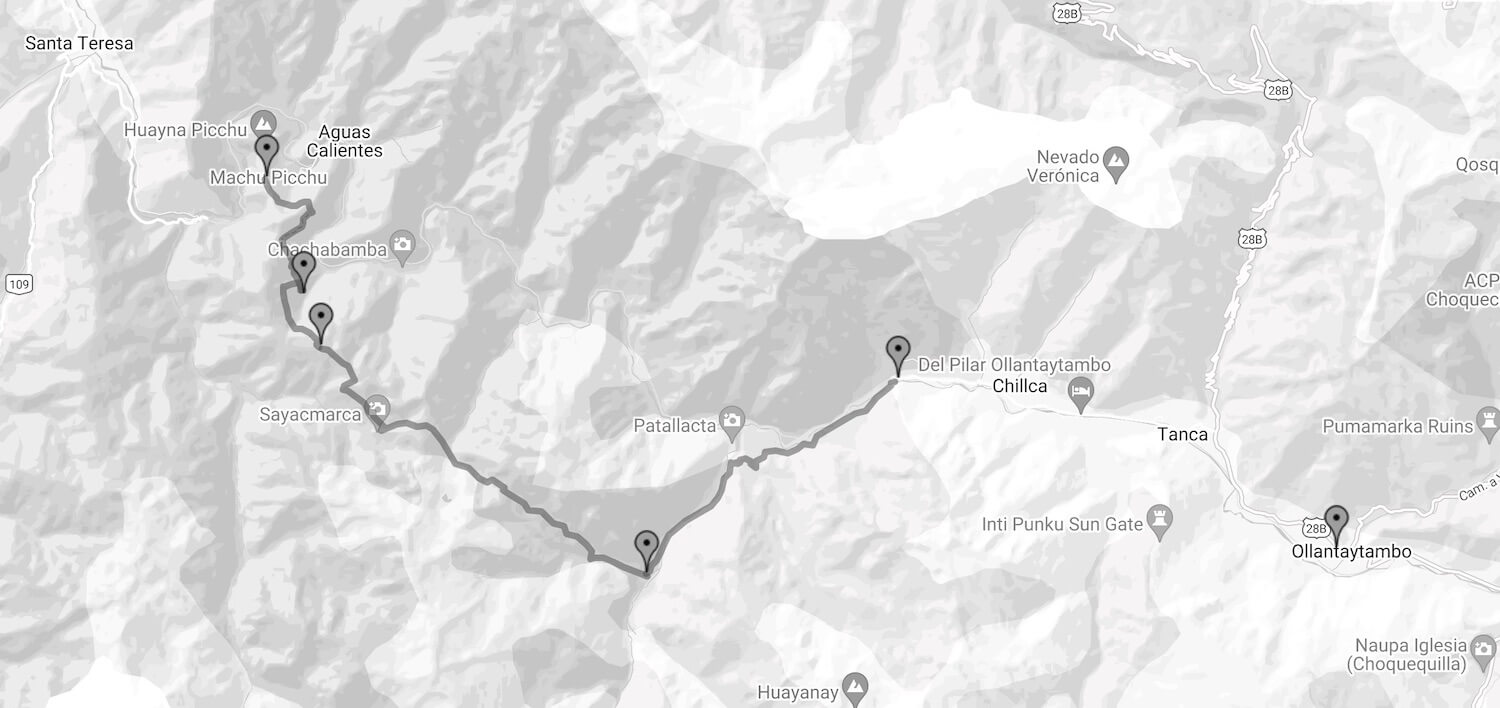
Inca Trail 4 Days map
The classic 4-day Inca Trail is the most classified and popular trek in all of Peru, it is so special because only about 200 tourists can hike the route each day, and a special permit is required.
Here is the Inca Trail map of where it starts and how to get to Machu Picchu.
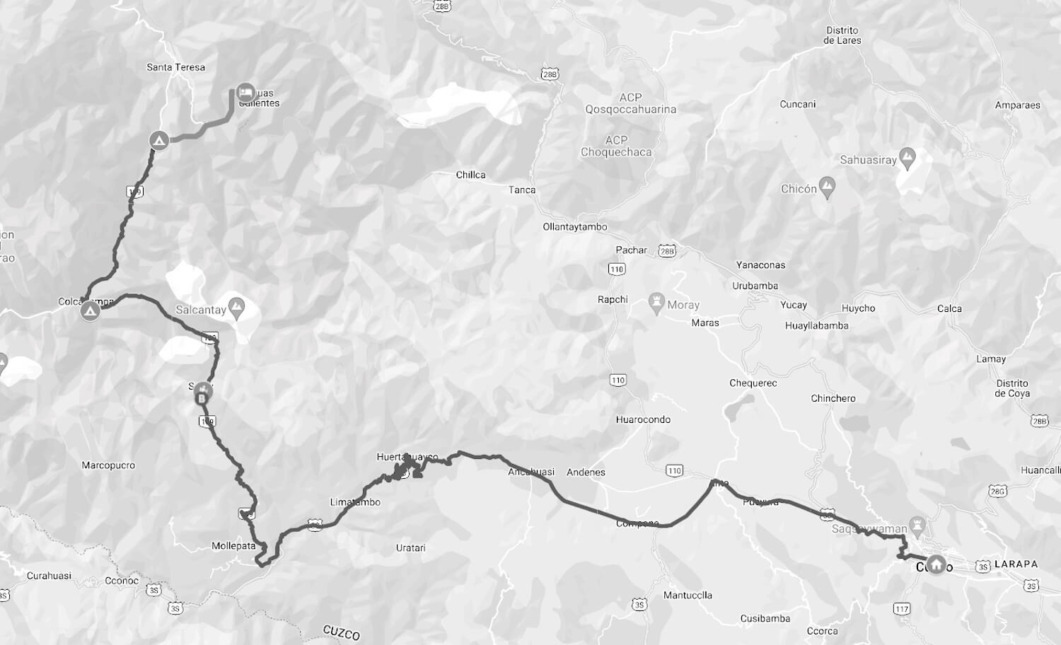
Salkantay Trek 5 days map
The Salkantay Trek is one of the best alternatives to the Inca Trail, unlike the other, this one does not require a permit but has unique and incredible landscapes. By this route you can visit the Humantay Lake, the Salkantay Pass, Santa Teresa and finally reach Machu Picchu.
Here is the Salkantay Trek map of where it starts and how to get to Machu Picchu.
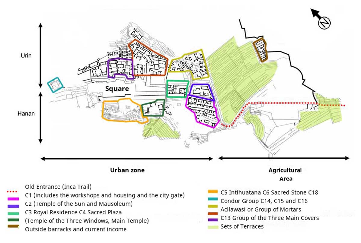
Machu Picchu Urban and Agricultural sector Map
The lost city of the Incas, Machu Picchu, is divided into two zones, one urban area and the other for agriculture.
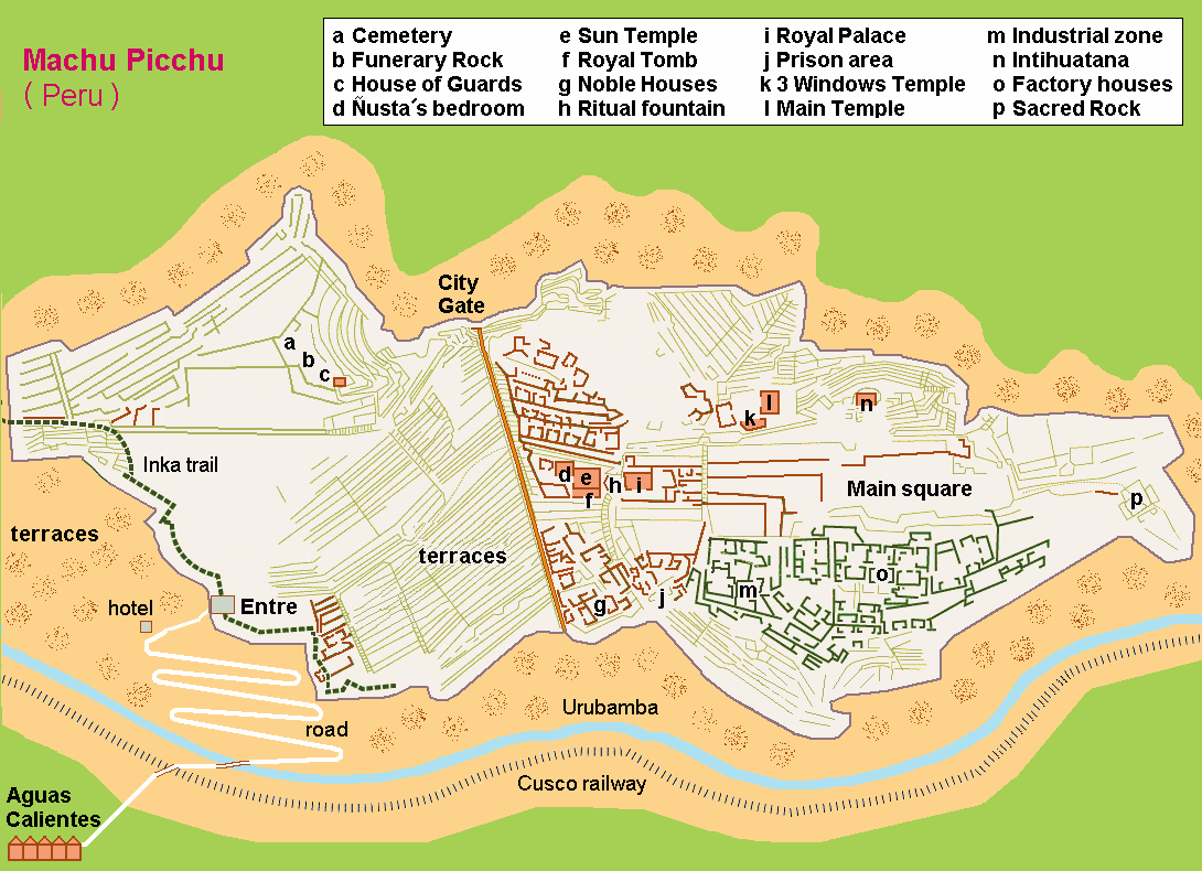
Machu Picchu sanctuary map
This citadel, Machu Picchu, has several sectors like any other city. We have: cemetery, temples, royal palace, prison, industrial zone, agriculture, houses, areas for animals, and more.
Machu Picchu is protected and recognized by UNESCO.