 English
 Spanish
 Portuguese
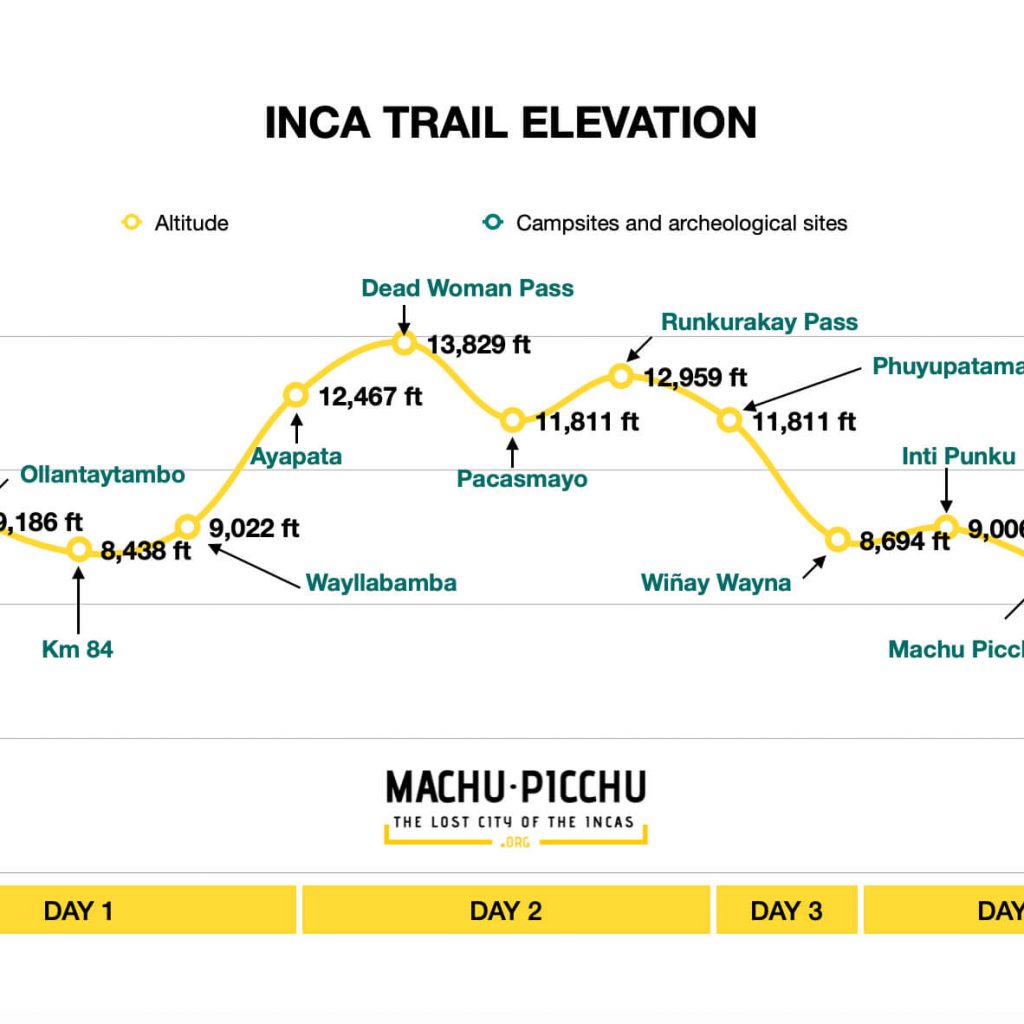
What are the elevation gains of the Inca Trail hike to Machu Picchu? In this article we are going to explain in detail the day by day elevation gain of the classic 4 day Inca Trail, this way you will understand how is the route of this famous trek.
The classic 4 day Inca Trail is not the only trek, there is the 2 day trek called the short Inca Trail and the one that links Salkantay with the Inca Trail (Salkantay and Inca Trail 7 Days).
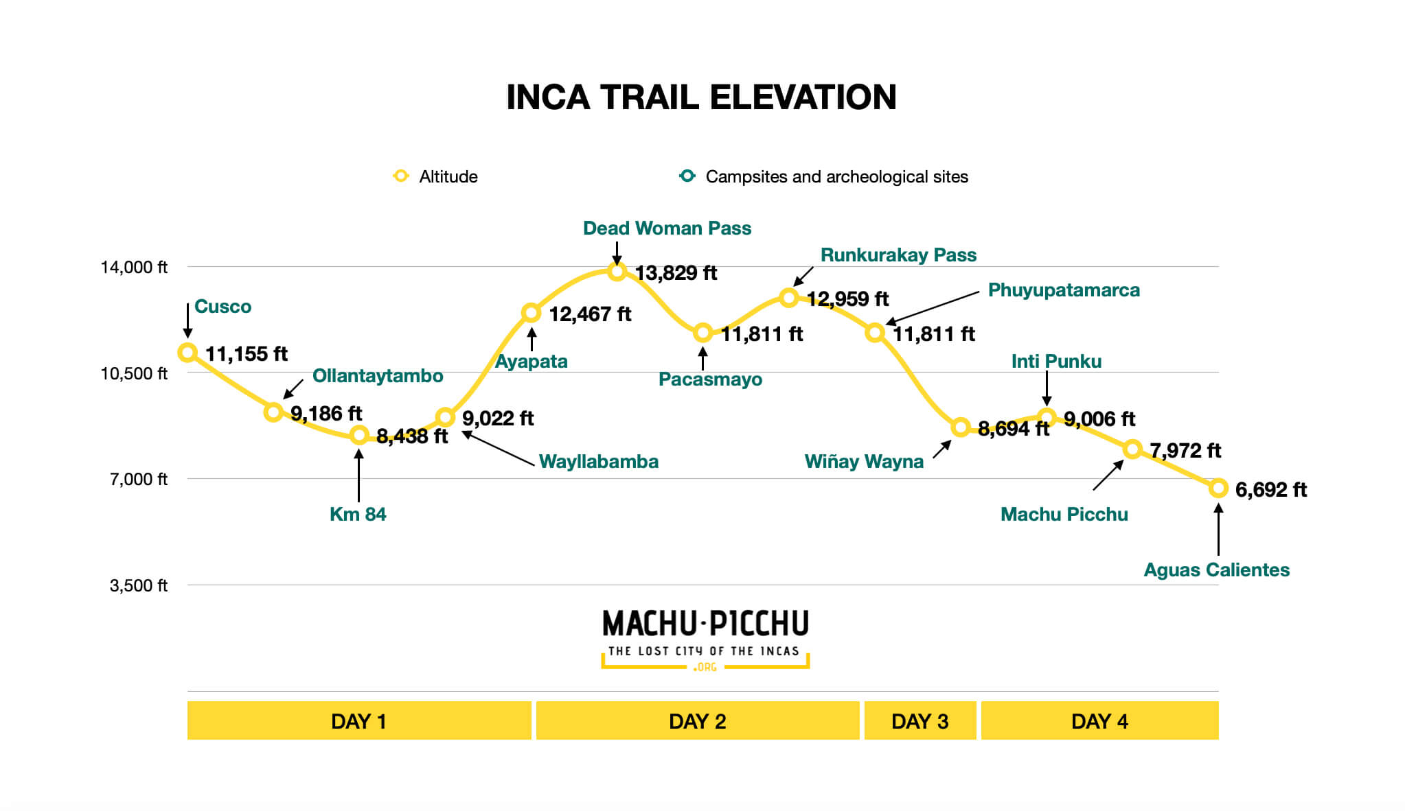
What is the elevation of the Inca Trail?
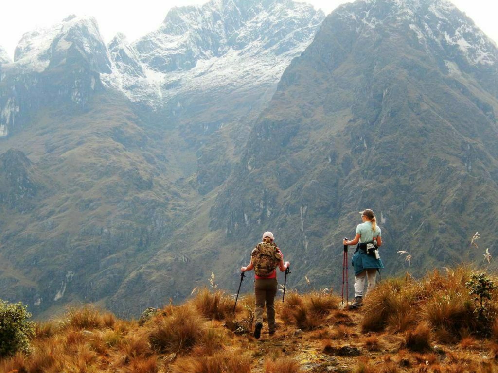
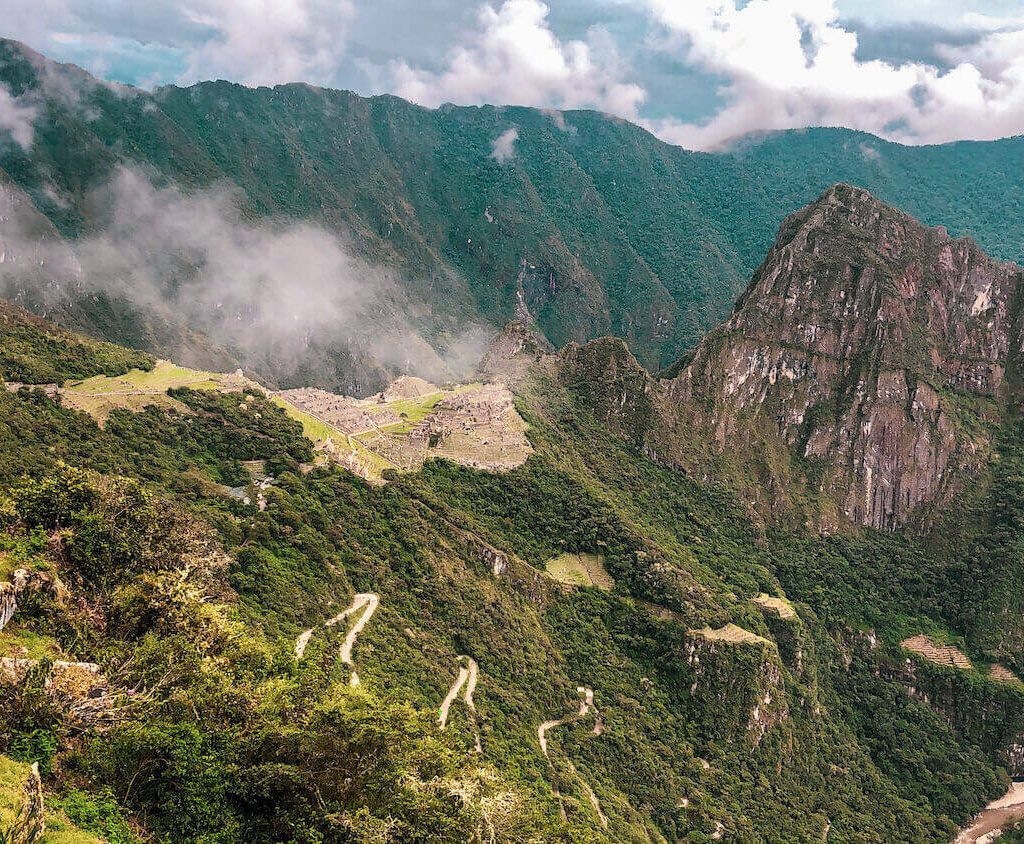
As you can see on the map, the elevation of the Inca Trail has many ups and downs. The easiest day is the first day, as it is relatively flat. The elevation of the Inca Trail varies, with the highest point rising to 13,828 feet (4200 m) above sea level. The second day is the hardest, starting at 10,000 feet (3,000 m) and ascending to Dead Woman’s Pass.
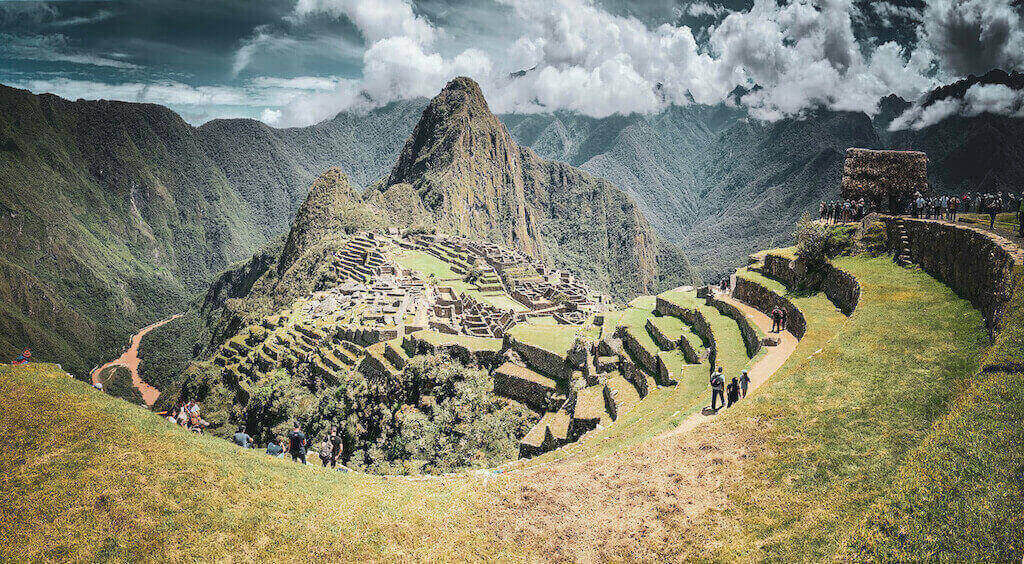
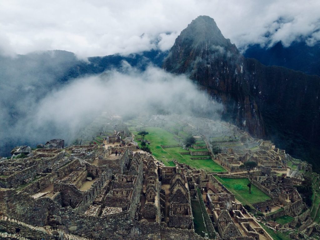
The third and fourth day of the Inca Trail altitude change is a relative descent to Machu Picchu. Machu Picchu is at an altitude of 2,430 meters.
Maximum altitude of the Inca Trail – 13,776 feet.
Inca Trail Elevation Map
Here is a standard itinerary that most Inca Trail companies have.
What is the 4 day Inca Trail itinerary like with day by day elevations?
Before starting the trek, you must remember to acclimatize to the altitude, you can read our blog about what to do in Cusco while acclimatizing.
Day 1 of the Inca Trail: Cusco – Piskacucho – Km 82 – Wayllabamba
The day starts very early, around 6 am, a transport picks us up along with all our travel companions and we go to Ollantaytambo. This is the last town where we will have to stock up on snacks and small things for the adventure. Then the transport takes us to Piskacuchu known as KM 82, where the government checkpoint for the Inca Trail is located.
Note: You can only do the Inca Trail with a government authorized tour operator.
Read our section on Best Inca Trail tour operators.
After passing the control we start the trek to the first base camp called Wayllabamba, but, before arriving we will have to have lunch in Miskay which is located in Llactapata or Patallacta which is also an archaeological site.
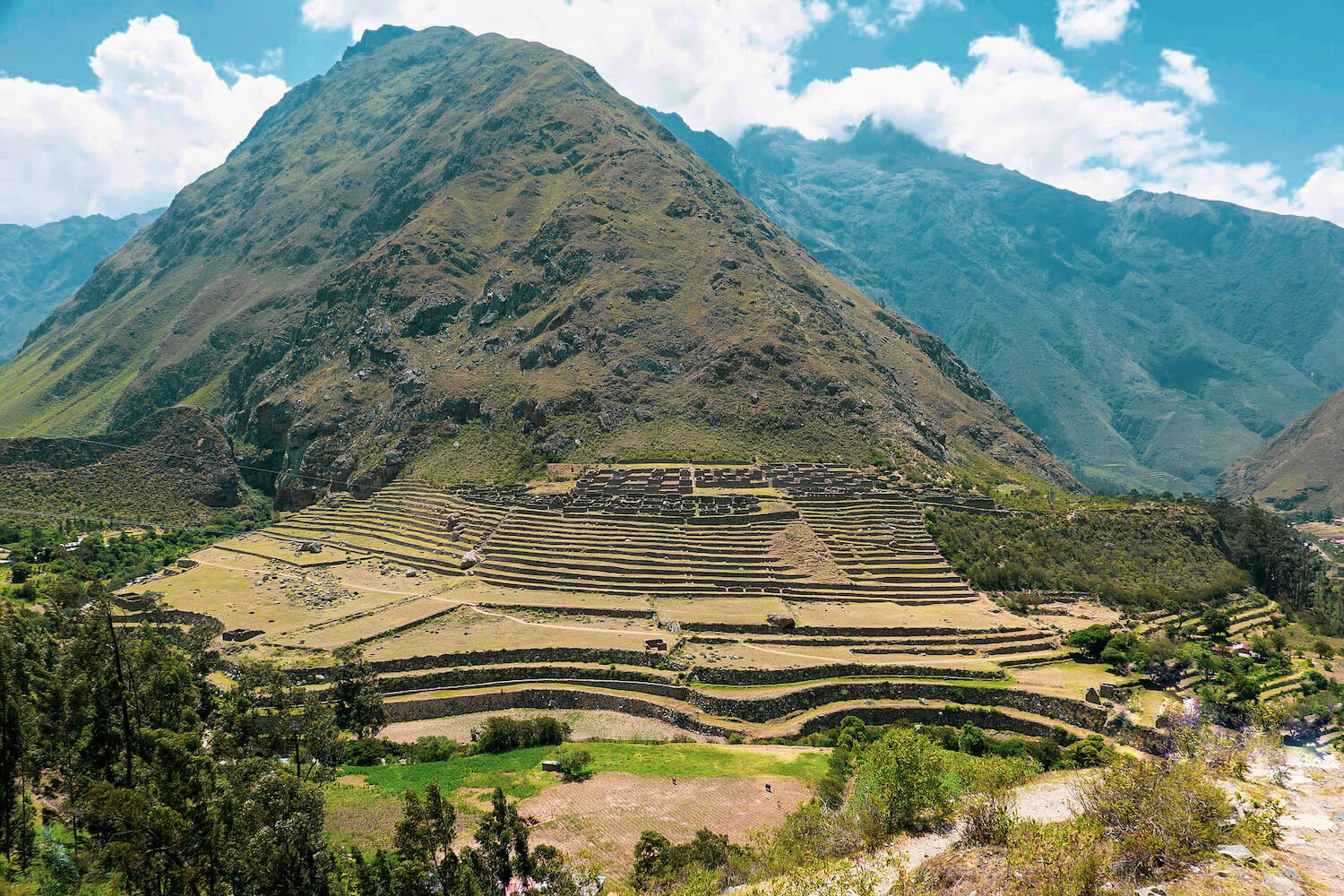
Before leaving Llactapata we will learn more about this place with our guide.
Summary of the first day:
- Distance: 12 km/6.835 miles.
- Time: 5 hours on average
- Elevation gain: 430 m/1410 ft.
- Start: Km 82 (beginning of the Inca Trail) 2680 m/9612 ft.
- End: Wayllabamba Camp 3,010 m/9,8750 ft. elevation gain of the Inca Trail.
Day 2 of the Inca Trail: Wayllabamba – Warmiwañusca – Pacaymayo
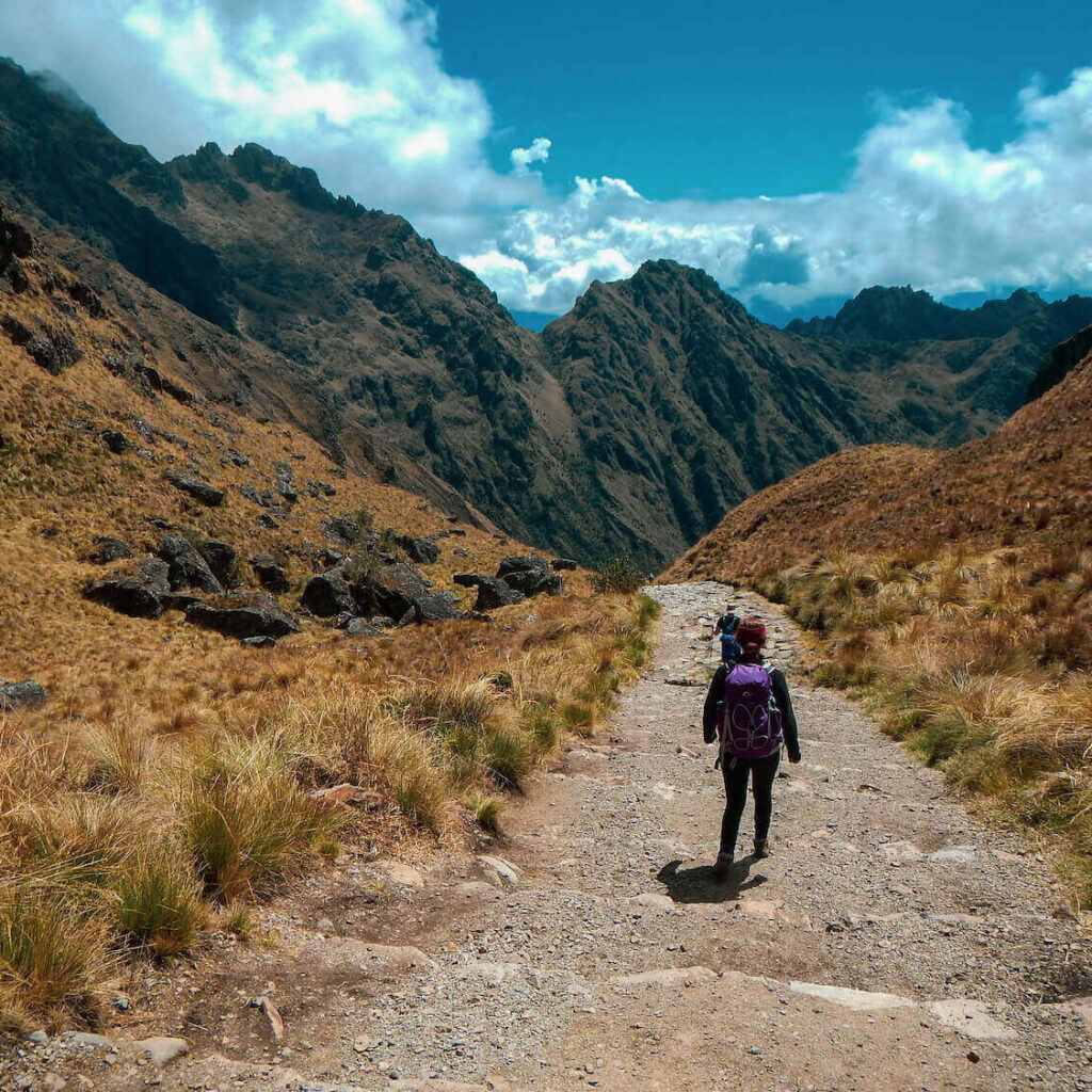
The second day is the most challenging day of the Inca Trail, we will have to climb up to Warmihuañusca (place of the dead woman) which is at 4200 meters above sea level. Warmihuañusca is also the highest point of the Inca Trail and from where we can appreciate the different varieties of flora and fauna of the Andes. After passing Warmihuañusca we will head towards Pacaymayo which is the second base camp of the classic Inca Trail. Pacaymayo is located at 3600 masl. In Pacaymayo we will also have our lunch and rest for the next day.
Summary of the second day:
- Distance: 11 km/6.83 miles.
- Time: 7 hours on average.
- Elevation gain: 1180 m/3871 ft.
- Start: Wayllabamba Camp 3,010 m/9,8750 ft.
- End: Pacasmayo Camp 3,600 m/11,700 ft.
Day 3 of the Inca Trail: Pacaymayo – Chaquicocha – Wiñaywayna
The third day starts early to head towards Runcurakay Pass, which is at 3850 masl (second highest point of the Inca Trail). Along the route we will visit the archaeological sites of Sayacmarca (village or site in the middle of a steep hill) and Phuyupatamarca (Village or site in the middle of the clouds). Then we will have our lunch and then head to Wiñaywayna where is our last base camp to get to Machu Picchu.
Wiñaywayna is already a few steps away from Machu Picchu, and it is also an archaeological site whose name means “eternal youth”.
In Wiñaywayna we will meet tourists who do the short Inca Trail of 2 days and we will also have the last dinner with our porters and cooks, they arrive only to this point and say goodbye to us.
Thanks to the porters and cooks is possible the Inca Trail lighter and more pleasant, so do not forget to give them a big hug and tips.
Summary of the third day:
- Distance: 16 km/9.94 miles.
- Time: 9 hours on average
- Elevation gain: 453 m/1486 ft.
- Start: Pacasmayo Camp 3,600 m/11,700 ft.
- End: Wiñaywayna Camp 2,650 m/8,530 ft.
Day 4 of the Inca Trail: Wiñaywayna – Machu Picchu – Cusco
The fourth day dawned and we have to start our hike very early if we want to see the sunrise at Machu Picchu. The final stretch of the Inca Trail takes us to the Inti Punku or translated Sun Gate from where Machu Picchu can be seen in all its splendor.
Then we will descend to enter the streets and terraces of the Inca citadel and finish our expedition knowing more about the culture and knowledge of the Incas.
After getting to know and finally reaching Machu Picchu we will descend to the town of Aguas Calientes where we will have lunch and wait for our train to return to Ollantaytambo and Cusco.
Summary of the fourth day:
- Distance: 6 km/3.72 miles.
- Time: 3 hours on average
- Elevation gain: 90 m/295 ft.
- Start: Wiñaywayna Camp 2,650 m/8,530 ft.
- End: Machu Picchu 2,450 m/8,038 ft.
Summary of Inca Trail Elevation Gain
- Total elevation gain of the Inca Trail: 2153 m/7063 ft.
- Top Elevation: 13,828 ft (4200 m)
- Inca Trail Distance: 25 miles (40 km)
After hiking the Inca Trail like a true expeditionary, you can enjoy Cusco and the other destinations it has to offer.